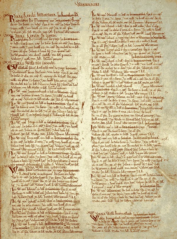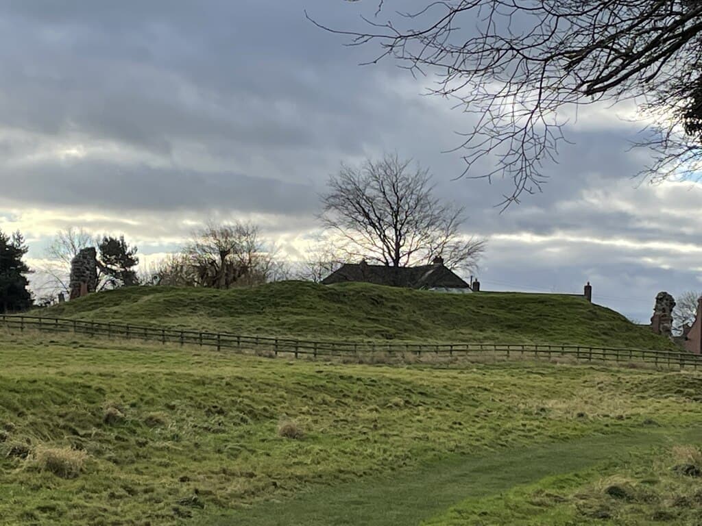
Shrawardine Castle survives as a mound, fragments of sandstone masonry and surrounding earthworks. The castle and associated settlement remains are a scheduled monument; the standing ruins are also listed Grade II. Historic England: monument ↗ and listed ruins ↗.
The surviving castle
Historic England describes the site as a shell-keep castle: a stone enclosure around the top of a castle mound, or motte. Its scheduling includes three baileys — defended enclosures — and settlement earthworks nearby. Historic England ↗.
The visible stonework is only part of the evidence. The county’s Historic Environment Record brings together excavations, surveys and building recording, including work undertaken in connection with consolidation of the masonry in 1997–98. Shropshire HER ↗.
Guarding the Severn: two castles
Shrawardine Castle occupied an elevated position overlooking a crossing of the River Severn. Historic England interprets it as a stronghold controlling the ford and records its use by Henry II during his campaigns against the Welsh in 1165–66. Historic England ↗.
Across the river, about 800 metres away, Little Shrawardine Castle survives as a separate motte-and-bailey site beside the southern bank. Its scheduled remains include a steep-sided mound, described as about nine metres high, and an adjoining bailey. Historic England suggests that it controlled the crossing and regulated river traffic approaching Shrewsbury from the west. Little Shrawardine scheduling ↗.
The relationship between the two castles is less certain. Historic England describes them as defending opposite sides of the ford, while the county HER’s summary of a 1998 building survey proposes that Shrawardine almost certainly replaced Little Shrawardine. Their shared association with the crossing is clearer than the sequence in which they operated. Historic England ↗; Shropshire HER, survey summary ↗.
The main castle also served as a residence. Historic England records that it became the principal home of Sir Thomas Bromley’s son after its sale to the Bromley family in the late 16th century. Historic England ↗.
Medieval origins and Castle Isabel
The castle existed by 1165, when Philip Helgot acknowledged castle-guard service at Shrawardine. Eyton’s account notes that the service had also been rendered by his predecessors; this does not establish when the castle was built. Eyton ↗.
Its foundation remains uncertain. Historic England suggests that it was founded by order of Henry I, while Jones’s archaeological account proposes a likely mid-12th-century origin. Historic England ↗; Jones, p. 15 ↗.
Historic England records destruction in a Welsh attack in 1215 and an order to refortify the castle in 1220. Jones treats the 1215 destruction as a supposition rather than a certainty. Historic England ↗; Jones, pp. 15, 18 ↗.
The castle subsequently belonged to the Fitzalans and was known as Castle Isabel. The chronology differs between official accounts: the scheduling places its return to Fitzalan hands by 1240, whereas Historic England’s research record gives a grant to John Fitz Alan in 1244. A precise transfer or rebuilding date should therefore be treated cautiously. Scheduling ↗; research record ↗.
The Civil War and destruction
During the Civil War, William Vaughan held the castle for the king. It surrendered to Parliamentarian forces in 1645. Historic England ↗.
Jones dates the surrender to 29 June 1645 and reports that the castle was apparently burned within two weeks. There is a conflicting date in the listed-building description, which says the castle was slighted — deliberately damaged — in 1644. The 1645 sequence is supported by both the scheduling and Jones’s account. Jones, pp. 15–16 ↗; listed-building entry ↗; scheduling ↗.
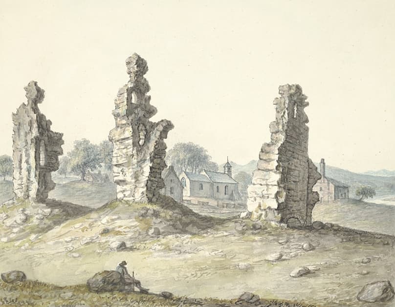 John Ingleby, Sh(r)awardine, 1796. National Library of Wales, PD9243. Public domain.
What archaeology reveals
Excavations in 1994 found a bank and ditch belonging to the castle’s defences and a two-chambered pottery kiln dated to the 12th–13th centuries. The kiln lay outside the bailey. Shropshire HER ↗.
Topographical and geophysical surveys in 2001 provided evidence for a possible earlier oval bailey east of the mound. Jones stresses that the proposed reconstruction is one interpretation of the evidence, not a definitive account. The arrangement of towers, entrances and buildings remains uncertain. Jones, pp. 18–21 ↗.
The survey article also reproduces a 1728 Bromley estate map showing the castle ruins and neighbouring buildings. It is useful evidence for the site after its destruction, rather than a plan of the intact medieval castle. Jones, pp. 16–17 ↗.
The castle and Millennium Green
The 2001 survey programme was organised by the Montford Parish Millennium Green Trust as part of work to manage and interpret the castle. Jones, p. 15 ↗.
Read more about Millennium Green. Related guides to St Mary’s Church and the River Severn are in preparation.
Sources & further reading
- Historic England, Little Shrawardine motte and bailey castle, NHLE 1019198 (scheduled 1976; amended 2000). Accessed 18 September 2026. ↗
- Historic England, Shrawardine castle and settlement remains, NHLE 1015707 (scheduled 1969; amended 1997). Accessed 18 September 2026. ↗
- Historic England, Remains of Shrawardine Castle, NHLE 1366944 (listed 1958; amended 1987). Accessed 18 September 2026. ↗
- Shropshire Historic Environment Record, Shrawardine castle and settlement remains, PRN 00052, via Heritage Gateway. Accessed 18 September 2026. ↗
- N. W. Jones, Archaeological Surveys at Shrawardine Castle, with discussion by John Kenyon, Transactions of the Shropshire Archaeological and Historical Society, vol. 77 (2002), pp. 15–25; published 2004 according to the HER. Accessed 18 September 2026. ↗
- R. W. Eyton, Antiquities of Shropshire, vol. X (1860), Shrawardine, online transcription. Accessed 18 September 2026. ↗
- Historic England Research Records, Shrawardine Castle, Hob UID 67867, via Heritage Gateway. Accessed 18 September 2026. ↗